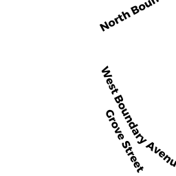
150 GROVE ST
Owner Information
150 GROVE ST REALTY LLC
C/O RAND-WHITNEY GROUP LLC
WORCESTER, MA 01607


Property Details
150 GROVE ST is classified as a Buildings for manufacturing operations (Light manufacturing).
The primary structure on this property was built in 1955. There are 163751ft2 of built area within this property. There is 163751ft2 of residential/living space within this property.
150 GROVE ST is valued at 4838700. The land is valued at 905900 and the structures are valued at 3932800.
This property is in Zone BG-6. Confirm with local Zoning Board authorities to ensure there are no overlays or other easements on this property.
The most recent deed for 150 GROVE ST is recorded at the local registrar in Book 32143, Page 0358. 150 GROVE ST was last sold on 2003-11-03 for 4060000.
Assessment data from fiscal year 2021.
Flood Data
According to the FEMA National Flood Hazard Layer, this property does not appear to be in a flood zone. It may also be in an area not yet reviewed. Nonetheless, confirm this information prior to taking any action.
To view the flood hazards around this property, create a FEMA "Firmette" Map of the area around 150 GROVE ST.
Broadband Internet Providers
| Provider | Type | Bandwidth (mbps) | |
|---|---|---|---|
| MCI | Copper Wire | 0 | 0 |
| HughesNet | Satellite | 25 | 3 |
| GCI Communication Corp. | Satellite | 0 | 0 |
| Charter Communications Inc | Cable | 940 | 35 |
| EarthLink Business, LLC | Fiber | 0 | 0 |
| Verizon New England Inc. | DSL | 15 | 1 |
| Viasat Inc | Satellite | 100 | 3 |
| VSAT Systems, LLC. | Satellite | 2 | 1 |
| Crown Castle Fiber | Fiber | 0 | 0 |
Broadband service provider data from December 2020.
Adjacent Properties
- 0180 GROVE ST
Cemeteries (Charitable Org.) owned by PROPRIETORS OF RURAL CEMETERY - 112 R GROVE ST
Other Storage, Warehouse, and Distribution facilities (see also usecode 401) owned by GROVE STREET FAMILY PROPERTIES LLC - 95 PRESCOTT ST
Eating and Drinking Establishments - restaurants, diners, fast food establishments, bars, nightclubs owned by HEMMETER,VINCENT TRUSTEE - 95 PRESCOTT ST
Buildings for manufacturing operations owned by 95-99 PRESCOTT STREET HOLDINGS LLC